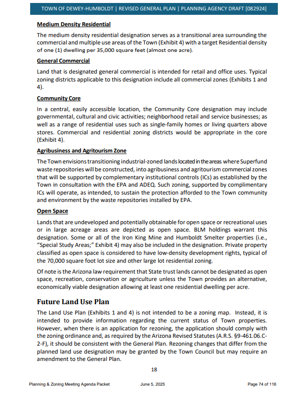
General plan
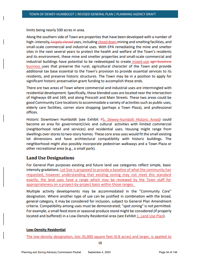
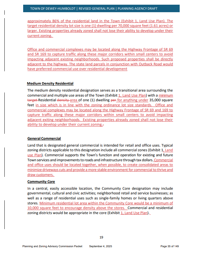
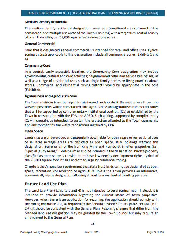
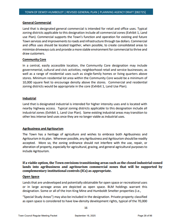
Between the Mayor, the Town Manager and the Town Planner, someone switched the land use map and wording in the General Plan. It caught the Planning and Zoning Commissioners off guard at the last meeting. Read over the maps and wordage for LOW DENSITY. The original wording said nothing about 35,000 square feet.
** New Finding by citizen on 9-28-2025 – Community Core is changed in a similar way – see below**
UPDATE: September 16th, 2025 Town Council Meeting – council voted to adopt the UPDATED General Plan which included the LOW DESnsity changes described above and below.
VOTED YES to ADOPT the GENERAL PLAN -Mayor Fenn, Councilmembers Chisholm, Donovan and Mallette
VOTED NO to ADOPT the GENERAL PLAN – Councilmembers Nolan, Rogers and Barron
A successful yes vote would pave the way for higher density lots
**The mesaure failed with a 3-4 vote – it needed a 2/3 vote
Low Density Change
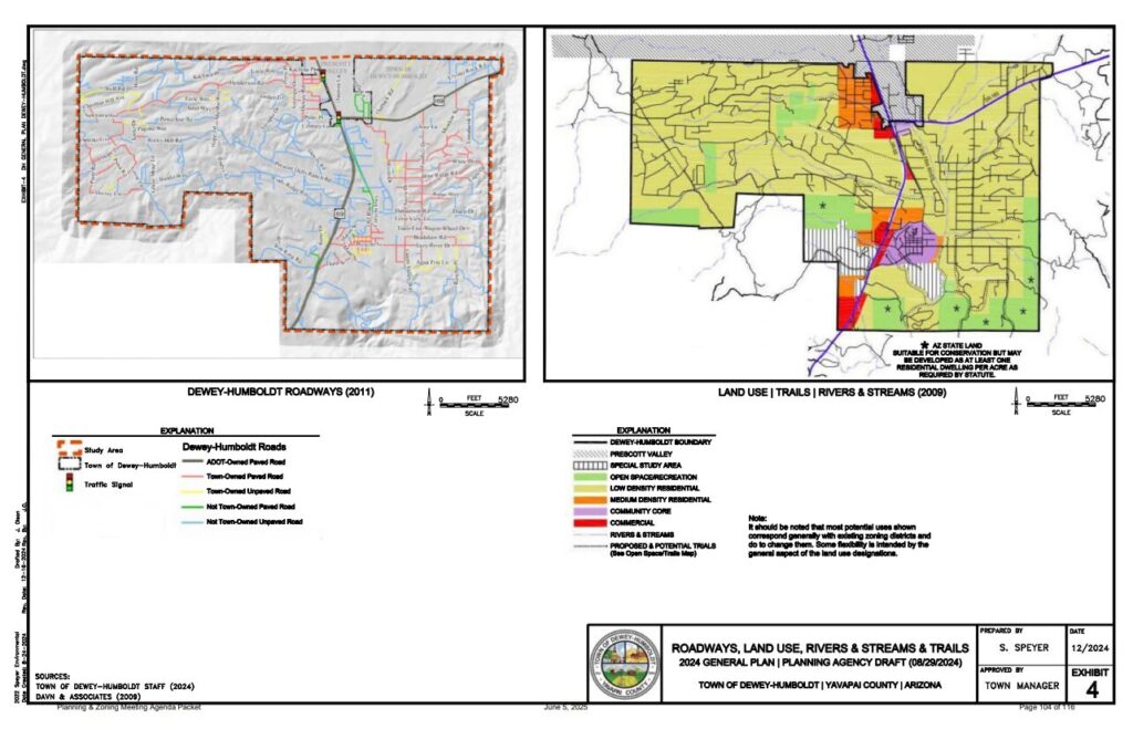
The June 5, 2025 meeting had a land use map in the General Plan with:

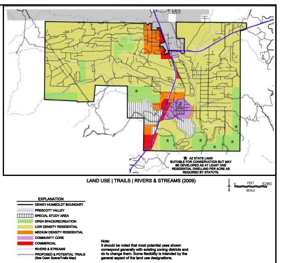
The September 4th, 2025 meeting had a different map in the General Plan with:

Above : There is a large tan/brown area along SR69 for medium density that didn’t exist before. This means possible rezoning and more housing.
Community Core
The June 5, 2025 – P and Z meeting had Community Core in the General Plan with:
The September 4th, 2025 – P and Z meeting had different wording for Community Core in the General Plan that changes density:

The September 16th Council meeting had the same different wording for Community Core in the General Plan that changes density too:
The P and Z commissioners didn’t make the changes, they just happened before the meeting
Here is the meeting where the mayor explains that this is how it needs to be in the General Plan. What? Didn’t address how we went from 70,000 lot to 35,000 lots: https://dhaz.granicus.com/player/clip/2507?view_id=2&redirect=true